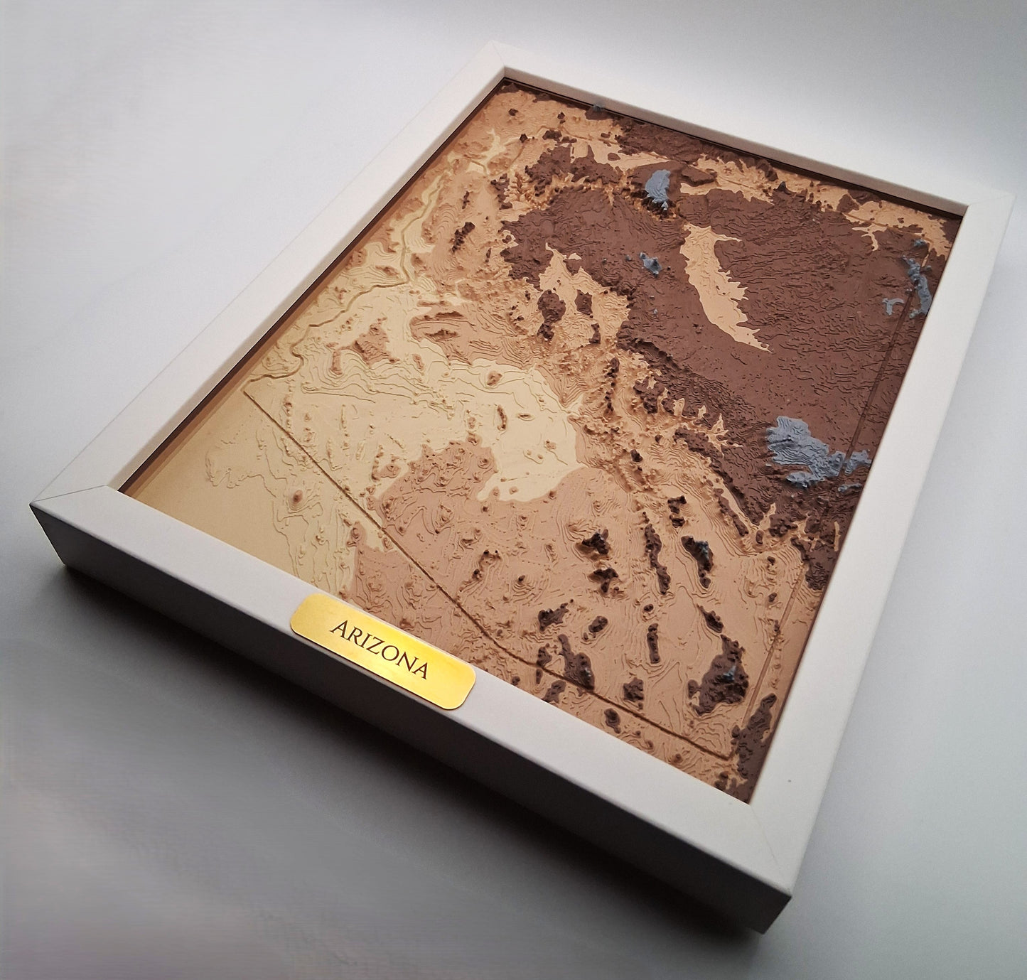
Explore the entire state of Arizona in 3D with this topographic map—an accurate raised-relief model created from real elevation data. This framed piece highlights Arizona’s dramatic landscapes, from the Grand Canyon and Mogollon Rim to desert basins, sky islands, and volcanic peaks, capturing the state’s full geographic diversity.
Each model is generated from authentic USGS elevation data and transformed into a detailed 3D terrain surface. The result is clean, modern wall art that blends scientific precision with minimalist design—perfect for Arizona natives, travelers, hikers, students, and anyone who loves Southwest landscapes.
Why This Piece Stands Out
• Authentic topography: Built from real USGS elevation data for scientifically accurate terrain.
• 3D raised-relief surface: Layered depth brings Arizona’s mountains, plateaus, and desert basins to life—similar to reading a tactile topographic map.
• Premium frame included: Comes ready to display in a deep 8×10″ frame, available in multiple styles to match any space.
• Made in Arizona: Designed, 3D printed, and framed locally in the USA with careful craftsmanship.
• Gift-ready: A meaningful piece for Arizona natives, hikers, travelers, geographers, or anyone who loves the landscapes of the Southwest.
Care & Display
Hang using standard nails or adhesive picture hooks. Avoid prolonged direct sunlight to preserve color and finish.
Specifications
• Frame Size: 8×10″
• Outer Dimensions: 8.7×10.7″
• Materials: Colored PLA terrain model + Brass Tag + Engineered-wood frame
• Weight: ~20.5 oz (580 g)
• Included: Finished framed art piece, ready to display