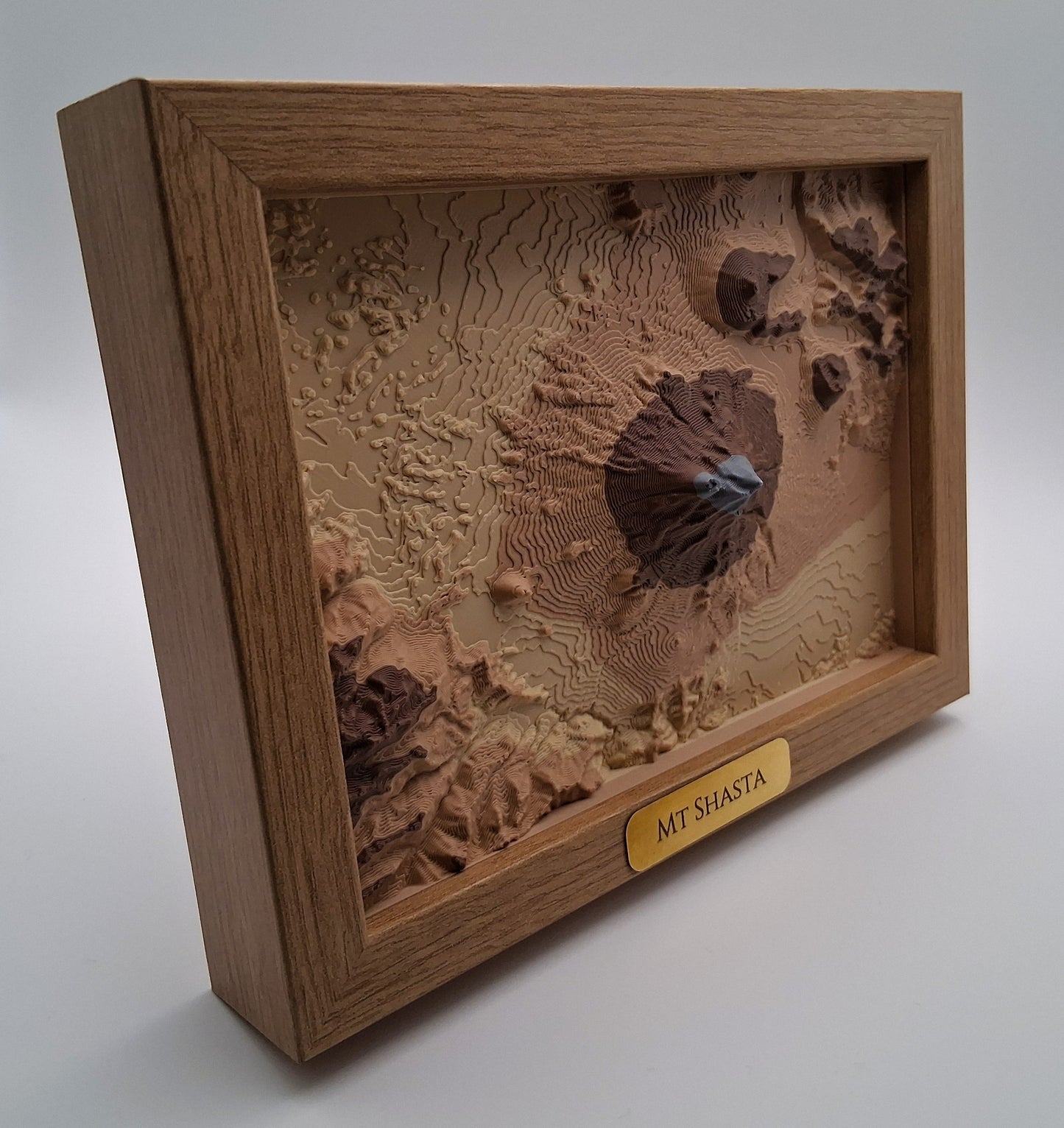
Explore Mount Shasta’s dramatic volcanic landscape with this 3D topographic map—an accurate raised-relief model created from real elevation data. This framed terrain piece highlights the steep ridges, lava domes, and glacier-cut valleys of one of California’s most iconic stratovolcanoes, making it a striking gift for hikers, climbers, and lovers of Northern California’s wild landscapes.
Each model is crafted from authentic USGS elevation data and transformed into a detailed 3D surface that brings out the mountain’s true structure. The result is clean, modern wall art that blends scientific precision with minimalist design.
Why This Piece Stands Out Authentic topography: Derived from real USGS elevation data for accurate terrain. 3D raised-relief surface: Layers mimic the experience of reading a topographic map. Premium frame included: Deep 5×7″ frame (multiple frame styles available). Made in Arizona: Designed, printed, and framed locally in the USA. Gift-ready: A unique idea for hikers, outdoor lovers, or Mount Shasta California visitors.
Care & Display Can be hung using standard nails or adhesive picture hooks. Avoid prolonged exposure to direct sunlight to preserve color and surface finish.
Specifications • Frame Size: 5×7″ • Outer Dimensions: 5.8×7.8″ • Materials: Colored PLA terrain model + Brass Tag + Engineered-wood frame • Weight: approx. 12 oz / 340g • Included: Finished framed art piece, ready to display